ARTSAKH. MOUNTAINOUS KARABAKH REPUBLIC
GEOGRAPHICAL LOCATION
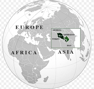
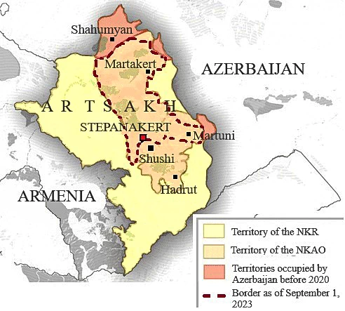
Mountainous Karabakh Republic is better known in the international arena under the Russian-language term “Nagorno-Karabakh Republic (NKR)”. It is the second Armenian state in Western Asia.
Its territory occupies the northwestern part of the Armenian Highland and comprises approximately one fifteenth of the historical territory of Armenia.
The territory of the republic is located between 39.5°–40.5° north latitude and 46.5′–47.5′ east longitude.
It borders Azerbaijan. The borders are indistinct. The republic has no access to the sea.
The original Armenian name of the region is Artsakh. This is precisely how the second and indigenous name of this republic is rendered.
The Artsakh ashkhar (“world,” province) of Greater Armenia occupied the eastern part of the Lesser Caucasus and the northeastern part of the Armenian Highland. It included the territory of the NKR as of 1 September 2020 and extended as far as the Ijevan region of the present-day Republic of Armenia. To the northeast and east it bordered the ashkhar of Utik, to the west — the ashkhar of Syunik along the Aghavno River. In the northwest, the borders of Artsakh ran along the eastern shore of Lake Sevan; in the south — through the Yeraskh valley to the Mughan Plain, including the western half of that plain.
THE STATEHOOD OF ARTSAKH
For millennia, Artsakh was part of a unified Armenian state or existed as separate independent or semi-independent Armenian principalities. Despite invasions by the Seljuks, Tatar-Mongols, and Persians, Artsakh always remained inhabited by Armenians.
Turkic-speaking tribes that later settled in the region called it Karabakh. Unfortunately, this name subsequently became widespread. After the proclamation of the First Republic of Armenia, Artsakh effectively became part of it. Even then, Azerbaijan became involved with the idea of seizing Karabakh, but in practice was hardly able to establish its authority there. Karabakh recognized only the authority of the Republic of Armenia (1918–1920).
In 1921, the entire historical territory of Artsakh was transferred under the jurisdiction of Azerbaijan by a decision of the Caucasian Bureau of the Russian Communist Party (Bolsheviks). Within Azerbaijan, the Nagorno-Karabakh Autonomous Oblast (abbreviated: NKAO) was established in 1923. The Azerbaijani authorities delineated the borders of the NKAO in such a way that it was separated from Soviet Armenia. A buffer zone 6–30 km wide emerged between the NKAO and the Armenian SSR. In addition, several areas remained outside the oblast, including the eastern and southern parts of the Artsakh Plain, as well as the Armenian-populated Gulistan in the north.
The highest state body of the NKAO — the Supreme Council of People’s Deputies of the Autonomous Oblast — adopted a decision in 1988 to withdraw from the Azerbaijan SSR and to reunite with the Armenian SSR. On 2 September 1991, a joint session of the Supreme Council of People’s Deputies of the Autonomous Oblast and the representatives Armenian-populated Shaumyan district of Azerbaijan SSR adopted the Declaration on the establishment of the second independent Armenian republic — the Mountainous Karabakh Republic, better known in the international arena under the Russian-language term “Nagorno-Karabakh Republic (abbreviated: NKR)”. The proclamation of the the Mountainous Karabakh Republic (‘NKR”) fully complied with the internationally recognized right of peoples to self-determination and with the laws of the USSR.
On 10 December 1991, a referendum on independence was held. With a turnout of 82.17%, 99.01% voted in favor of the proclaimed Mountainous Karabakh Republic (‘NKR”) becoming an independent state, independently determining the forms of cooperation with other countries and associations.
 Despite this, Azerbaijan twice (in 1992–1994 and in 2016) attempted to suppress the national liberation movement of the Armenian population by military force and to eliminate the republic. Defending their right to self-determination, the Armenian population incorporated historically Armenian territories beyond the borders of the former NKAO and established a security zone.
These borders of the “NKR” remained in place until the 44-day war of 2020. On 27 September 2020, the Azerbaijani armed forces launched an offensive along the entire line of contact of Artsakh. On the night of 9–10 November, the leaders of Armenia, Russia, and Azerbaijan signed a statement ending the war. According to the trilateral declaration, part of the former Nagorno-Karabakh Autonomous Oblast (excluding the cities of Shushi and Hadrut) and the Lachin/Berdzor humanitarian corridor connecting it with Armenia remained under the control of the Mountainous Karabakh Republic. In 2022, the corridor was also transferred to Azerbaijan.
The status quo established after the 44-day war remained in effect until September 2023. After more than nine months of blockade, Azerbaijan launched another attack on Artsakh on 17 September. On 20 September, the entire territory of the republic came under Azerbaijani control amid ethnic cleansing of the Armenian population.
The state authorities of the Mountainous Karabakh Republic (‘NKR”) are currently functioning in exile on the territory of the Republic of Armenia.
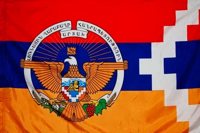
The Constitution of the Mountainous Karabakh Republic (‘NKR”) was adopted on 10 December 2006 and amended in 2017. The form of government is presidential. The head of state is elected by the National Assembly (33 deputies). The government consists of a State Minister and ministers.
POPULATION
As of 26 September 2020, the population of the Mountainous Karabakh Republic (‘NKR”) was 150,000.
The population was distributed relatively evenly. Rural population density was higher in valley and southeastern areas — the foothills of Martakert, Martuni, and Hadrut. In mountainous areas, settlement density was lower.
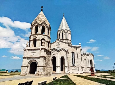
The most well-known cities were Stepanakert and Shushi. Eight additional settlements out of 377 had city status.
The ethnic composition of the population was homogeneous. In addition to Armenians, small numbers of Russians, Greeks, and Yazidis lived in the republic.
After the 44-day war, mass emigration significantly reduced the population. Approximately 30,000 displaced persons did not return to Artsakh. As of 1 December 2022, about 120,000 people lived in the Mountainous Karabakh Republic (‘NKR”). The population of the regions was about 56,000, while that of the capital Stepanakert exceeded 60,000. Since December 2022, population outflow began under blockade conditions through various means.
In September 2023, as a result of ethnic cleansing, the Armenian population of Artsakh was completely displaced to the territory of the Republic of Armenia. According to data as of 29 September, the number of forcibly displaced persons amounted to approximately 85,000.
NATURE
Geological Characteristics
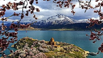
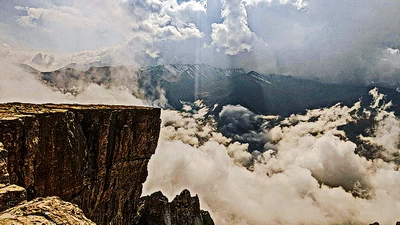
The territory of the Mountainous Karabakh Republic (‘NKR”) largely covers part of the historical Artsakh ashkhar of Greater Armenia. It is located almost in the central part of the South Caucasus, east of the folded mountains of the Lesser Caucasus. Most of the territory is mountainous. The elevation difference exceeds 3,600 meters.
In the northern part of the republic, the Mrav Range stretches from west to east, where the highest point is Mount Gomshasar (3,724 m). The lowest point is the valley of the Sevan River (112 m, Martuni region).
Forested mountain spurs extend eastward across the entire territory of the republic. The Shushi Plateau is well known, having a narrow tongue-like shape and gradually descending toward the valleys of the Karkar River and its tributary, Karintak.
Artsakh is located in the southeastern part of the Virahayots–Artsakh tectonic zone. The Mrav and Artsakh ranges consist of Jurassic limestone, Paleogene and Neogene volcanic and volcano-sedimentary rocks with numerous fractures and faults.
Modern tectonic movements play a significant role in shaping the relief.
Intermountain tectonic-erosional depressions — Stepanakert, Khachen, Haterk, and others — are located in the central and eastern parts of the republic. The bottoms of these depressions are covered with Quaternary rivers and stream deposits.
Numerous caves and ravines have formed in limestone formations. The Azokh Cave is particularly well known.
Located between the Eurasian and African-Arabian plates, Artsakh is influenced by their movement. The northern part of the territory lies in a seismic zone rated at 7 points, and the southern part at 8 points.
Climate
The climate of Artsakh is temperate, generally mild, and characterized by altitudinal zonation.
In the east — the plain zone — the climate is dry subtropical; in the foothills — moderately warm and dry; in the middle mountain zone — moderately warm and humid; and in high mountain areas — cold. The average January temperature on the plains is +2° to −2°, and in July +24° to +25°; in the middle mountain zone: January −2° to −4°, July +20° to +24°.
Annual precipitation also depends on altitude: 300–450 mm on plains and foothills, and 700–1,000 mm in middle mountain areas. A stable snow cover forms above 1,400 m, and on the Mrav Range snowfields persist even in summer.
Hydrographic System
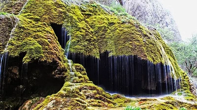
The hydrographic system is dense, with mixed river feeding and seasonal runoff (increasing in spring and partly in autumn).
The average annual water resources of Artsakh amount to 2.502 billion m³, of which 52% are surface waters, 47.92% groundwater, and 0.08% mineral waters.
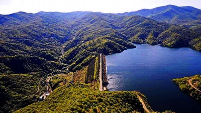
Artsakh’s hydrographic system is divided between the Kura and Araks river basins. Major rivers include the Haghari, Tartar, Khachen, Karkar, Sev-Jur, and Varanda.
The Sarsang Reservoir (capacity approximately 600 million m³) and a hydroelectric power plant (capacity 50,000 kW) were built on the Tartar River. There are also small lakes.
Biosphere

The plains are covered with steppe and semi-steppe vegetation. The foothills are covered with grasses gradually transitioning into shrubs and thickets.
Above 1,500 m, the forest zone begins, occupying more than one third of the republic’s territory. Typical species include oak, beech, spruce, elm, and pine. Numerous wild fruit trees grow here — pear, apple, walnut, rowan, cherry plum, rosehip, and others. At elevations of 2,000–3,500 m, subalpine and alpine meadows prevail. The upper basins of all Artsakh rivers are largely forested.
Wild fauna includes the Caucasian tur, argali, brown bear, badger, wild boar, forest cat, otter, as well as wolf, fox, hare, and numerous rodents. Reptiles such as snakes, lizards, and turtles inhabit the plains and foothills. The region has a rich birdlife.
Mineral Resources

The territory of Artsakh contains a wide variety of metallic and non-metallic mineral resources. Deposits of hard coal have been discovered near the villages of Maghavuz, Nareshter, and Kolatak in the Martakert region. In the regions of Martakert (Mehmana, Drmbon, Gyulatagh, Kusapat, Vank, Maghavuz), Martuni (Jardanashen), Hadrut (Tsor), Shushi (Chaghatsar), as well as between the Khachen and Tartar rivers on the slopes of the Mrav Range, there are deposits of polymetals, particularly zinc, copper, lead, gold, pyrite, iron, and tungsten.
Artsakh is also rich in non-metallic mineral resources, including numerous deposits of marble and multicolored marbleized limestone in the vicinity of Stepanakert and Shushi, as well as in the Askeran (Karaglukh, Sramort) and Martuni (Norashen, Chartar) regions.
There are deposits of granite, basalt, tuff, limestone, sand, and clay, as well as high-quality raw materials for cement and gypsum production, and numerous mineral water springs (Ttujur, Shrlan, Khater, Kolatak, and others).